
Our Services
-
Scheduling Information
All projects can typically be completed within 2–3 weeks of client approval. To begin work, we require a signed service agreement and a 50% deposit at the time of scheduling. This ensures timely project start, allows us to allocate resources, and keeps your survey on track for efficient completion.
-
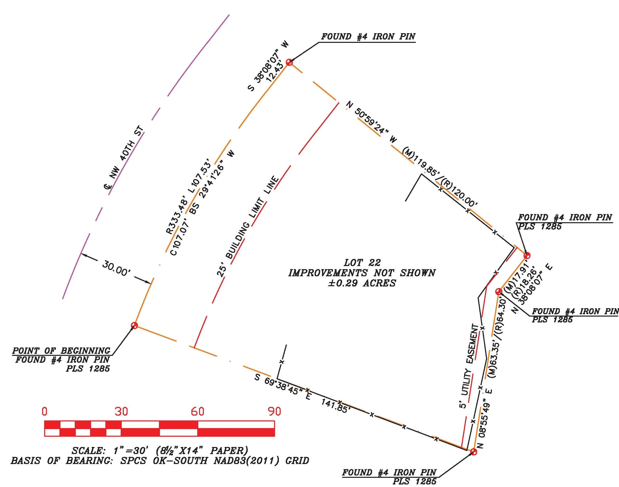
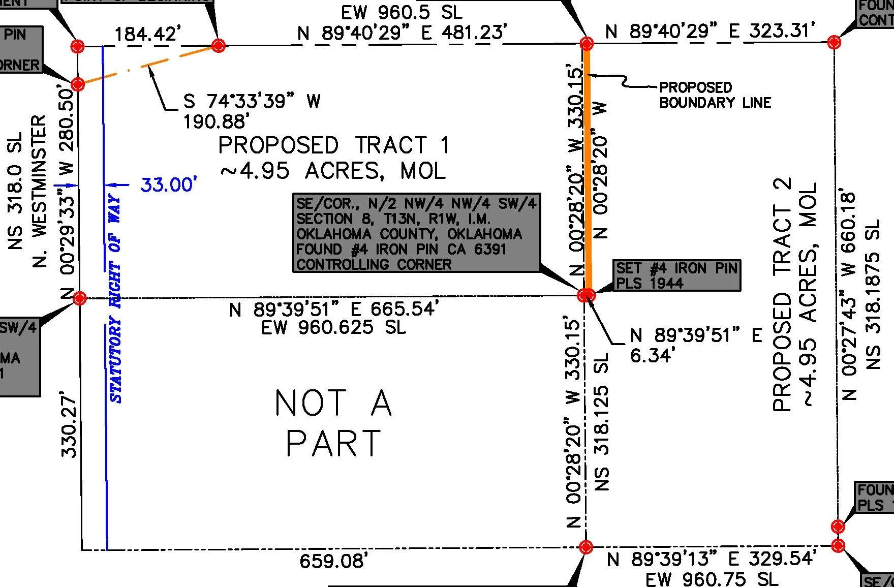
Boundary Survey
A boundary survey is a professional land survey that determines and delineates the legal boundaries of a parcel of real property. It establishes the location, dimensions, and corners of the property by locating recorded boundary lines, monuments, and legal descriptions, then reconciling those with physical evidence found on the ground. This survey will show property lines, setbacks, and subdivision plat easements.
Price starts at $500 USD
-
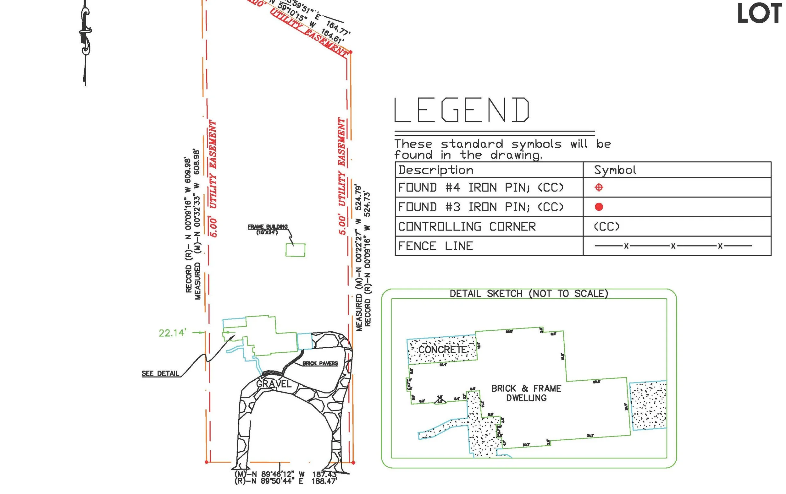
Certified Survey
A certified land survey includes everything found in a Boundary Survey, plus permanent structures, encroachments, and above‑ground utilities (if requested), as well as easements, providing a precise, scaled representation of a parcel of land and the features that affect its use, value, and legal status.
Pricing starts at $750 USD
-
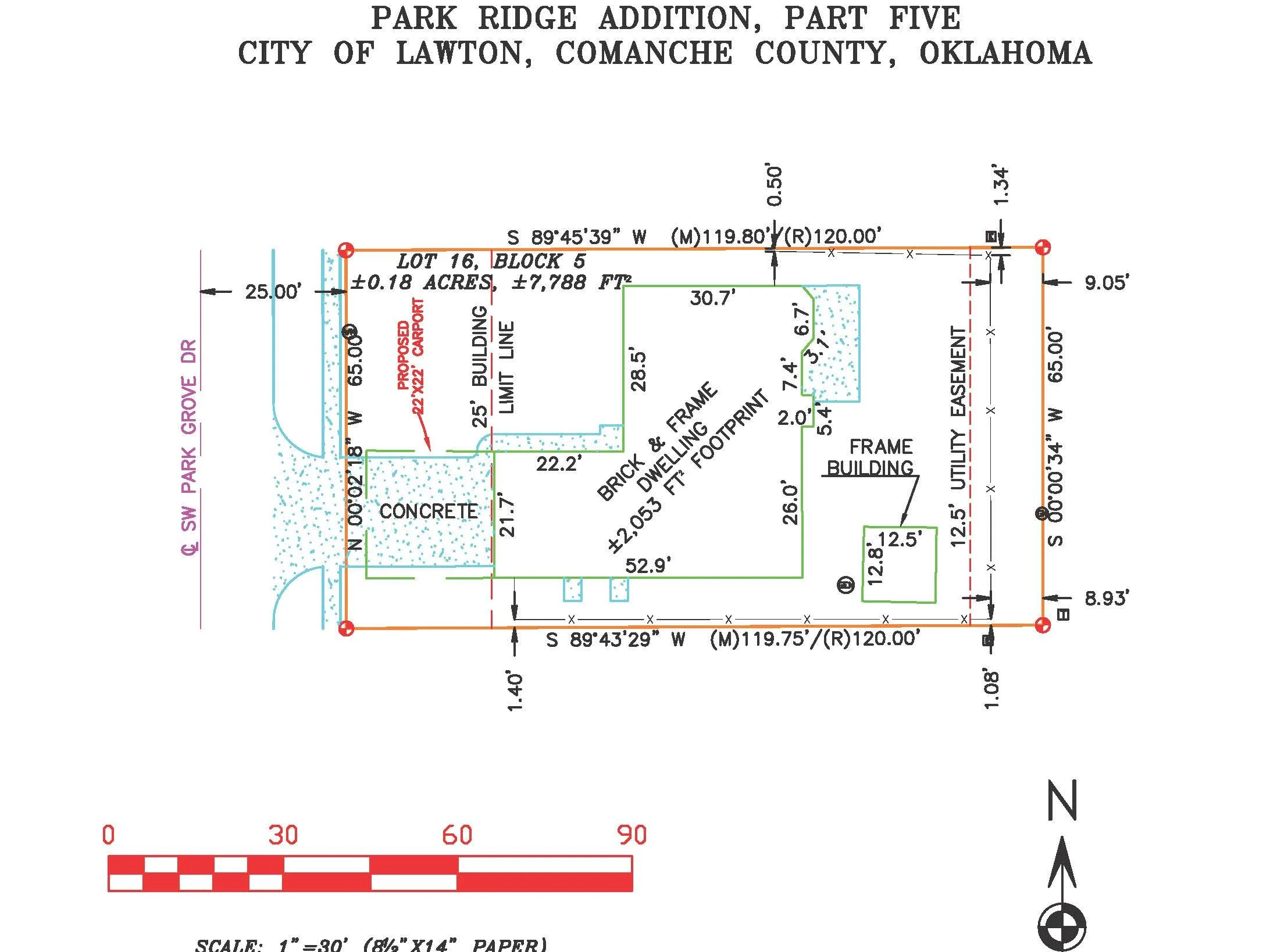
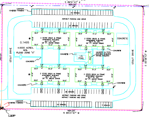
Site Plan
*A site plan is a scaled drawing showing a property’s layout, including property lines, existing structures, proposed buildings, driveways, and above ground utilities, serving as a crucial map for design, permits, and construction to ensure compliance with zoning, and regulations. It provides a bird's-eye view, detailing the property and proposed building location/layout.
Price starts around $850-$1,000 USD, depending on scope of project
-
Lot Split
A lot split legally divides one parcel into two or more smaller lots by creating a detailed survey plat, showing new property lines, dimensions, and legal descriptions that meet local zoning and municipal government approval to then be filed with the County Assessor. This will involve a Boundary survey and separate plats and/or legal descriptions for separated lots.
Prices start around $750 USD, depending on scope of project
-
ALTA/NSPS Survey
An ALTA/NSPS land survey is a comprehensive, standards-based boundary and property-improvement survey used primarily for commercial real estate transactions. It is performed to meet the joint minimum standards established by the American Land Title Association (ALTA) and the National Society of Professional Surveyors (NSPS). The survey provides detailed, certified information that supports title insurance, loan underwriting, risk assessment, and closing decisions. This comprehensive survey documents the entire property, detailing all features, including individual parking spaces.
Price starts at $1,600 USD, depending on scope of project*
-
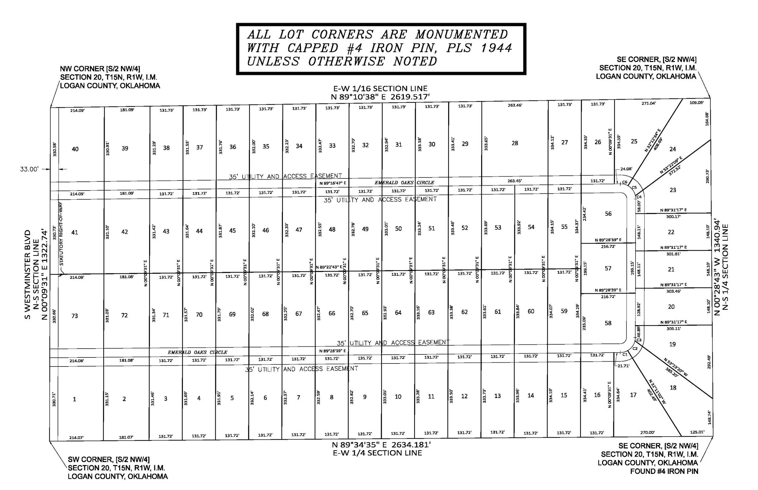
Subdivision
A subdivision survey produces a plat and does the fieldwork to split a large tract into smaller legal lots for sale or development. It includes designing new lot layouts, roads, and easements for municipal review and recording the final plat to create new legal parcels.
Pricing depends on the scope and consultation
-

We also provide surveying services for the following:
RESIDENTIAL
COMMERCIAL
TRIBAL LAND
GOVERNMENT PROPERTIES/CONTRACTS
CONSTRUCTION STAKING
SUBCONTRACT SERVICES
If you require a service not listed here, please message or call us and we’ll do our best to accommodate your needs.